
Draw or Edit a Trail on the Map
Using the Line String Tool
The ‘Line String Draw Tool’ can be used to easily ADD A MAP to a NEW or EXISTING TRAIL by DRAWING a trail right on your trail map page. It can also be used to EDIT an EXISTING TRAIL that is already mapped.
See video tutorial and instructions below to learn more.
Draw Tool Video Tutorial

Draw Tool Buttons
instructions for drawing a trail:
- on a new trail YOU ARE CREATING
or
- within a current trail on your list that is not mapped
1.) Within your ‘Trails’ menu, click on an existing trail card, then select ‘Edit Trail’ or create a new trail by clicking ‘+ New Trail’.


2.) The screen will shift to dark mode. On the upper right side corner of the map select the ‘Zoom In’ button to bring your map into closer view of where you will be drawing your trail.
NOTE: Gray lines indicate the existing trails within your trails system.

3.) Select the 'Line String Tool' and draw your trail by clicking and plotting points throughout the length of the trail. The plotted trail will appear as a series of orange dots.
4.) Double click to stop drawing.

5.) Move a point by selecting one of the larger orange circles and move as desired. The point you are moving will display larger than the other points.

6.) Add a point by selecting one of the larger orange circles near where you would like to add a point. A smaller point will appear to the left and right of the selected point. Click the new point and move as desired.

7.) Delete a point or the whole trail you drew by selecting the point or trail and hit 'delete' on your keyboard or select the 'trash' icon located under the 'Line String Tool'

8.) Undo or Redo an action if you make a mistake and need to go back or forward one or more steps.

9.) Move the whole trail by selecting the trail and dragging around as desired.

10.) Once you are happy with your trail click ‘Save’ and close out the screen
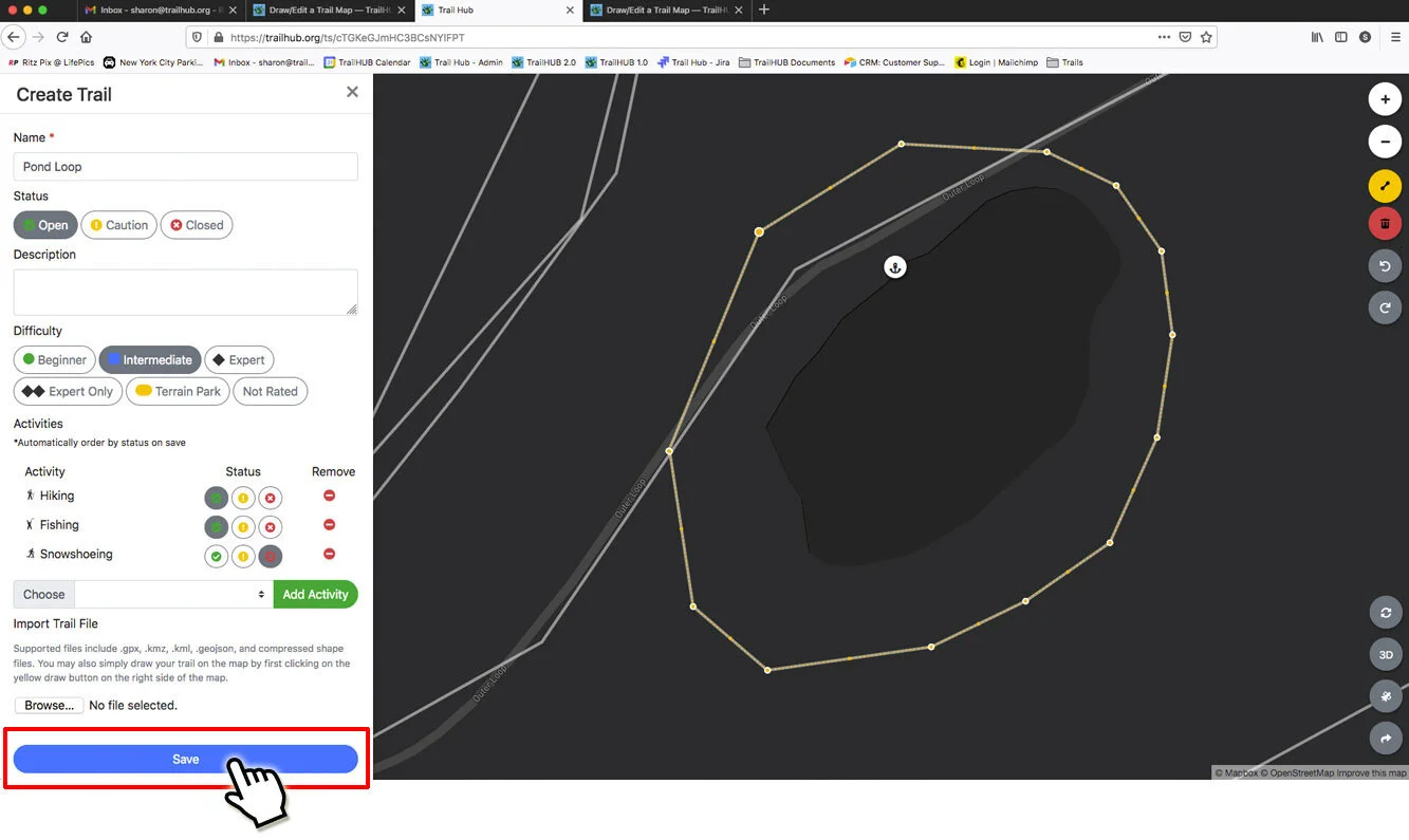
11.) The screen will shift back to standard color mode. An elevation map and total trail distance will appear under the information for your trail, and the trail you just drew will show up in the map on the right.

12.) Total trail distance will also appear in the upper-right corner of the trail card within your ‘View Trails’ menu.

instructions for Editing an existing Trail that is already mapped
1.) Within your ‘View Trails’ menu, click on the trail card you would like to edit, then select ‘Edit Trail’.


2.) The screen will shift to dark mode and the trail map for the trail you are editing will appear as a blue line. The other trails on your map will be gray.

3.) Click on the blue line to start editing the trail. Once selected, the blue line will be converted to a series of orange dots indicating you are now in editing mode.

4.) Move a point by selecting one of the larger orange circles and move as desired. The point you are moving will display larger than the other points.

5.) Add a point to by selecting one of the larger orange circles near where you would like to add a point. A smaller point will appear to the left and right of the selected point. Click the new point and move as desired.

6.) Delete a point or the whole trail you drew by selecting the point or trail and hit 'delete' on your keyboard or select the 'trash' icon located under the 'Line String Tool'

7.) Undo or Redo an action if you make a mistake and need to go back or forward one or more steps.

8.) Move the whole trail by selecting the trail and dragging around as desired.

9.) Once you are happy with your trail click ‘Save’ and close out the screen

10.) The screen will shift back to standard color mode. An elevation map and total trail distance will appear under the information for your trail, and the trail you just edited will show up in the map on the right.

11.) Total trail distance will also appear in the upper-right corner of the trail card within your ‘View Trails’ menu.
